Community Corner
Severe Weather Could be on Tap This Afternoon, Evening
Thunderstorms, as well as the potential of hail and tornadoes, are in the forecast for later today.
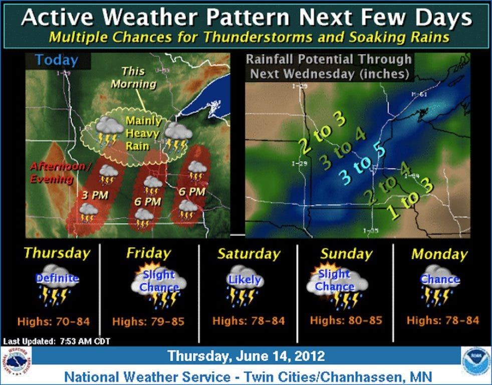
The weather in Burnsville and Dakota County will be anything but quiet today.
At 11:37 a.m., the National Weather Service issued the following hazardous weather outlook for central and southern Minnesota, including Burnsville and Dakota County:
"SEVERE THUNDERSTORMS ARE EXPECTED TO INTENSIFY ONCE AGAIN THIS AFTERNOON. ONE AREA OF STORMS WILL DEVELOP ALONG A COLD FRONT THAT WILL MOVE INTO WEST CENTRAL MINNESOTA...WITH OTHER STORMS CONTINUING OVER EAST CENTRAL MINNESOTA...AND THEN DEVELOPING INTO SOUTH CENTRAL MINNESOTA. LARGE HAIL AND DAMAGING WINDS ARE THE PRIMARY SEVERE WEATHER THREATS...BUT A TORNADO OR TWO CANNOT BE RULED OUT IN THE VICINITY OF THE OUTFLOW BOUNDARY FROM THIS MORNINGS ACTIVITY...WHICH WILL RESIDE NEAR THE METRO AREA THIS AFTERNOON. THE MOST FAVORABLE TIMES FOR SEVERE WEATHER WILL BE BETWEEN 1 PM AND 10 PM. STAY TUNED TODAY FOR ANY POTENTIAL SEVERE WEATHER WATCHES AND WARNINGS."
Find out what's happening in Burnsvillewith free, real-time updates from Patch.
Also in weather news Thursday:
• A flood advisory for urban and small streams had been issued for the Twin Cities area Thursday morning. It was expected to expire at 12:30 p.m.
Find out what's happening in Burnsvillewith free, real-time updates from Patch.
• The weather service predicted that could develop over the southern Twin Cities metro area through early afternoon.
Click here for the latest forecast for Burnsville.


